Honeywell Radar Velocity System
Overview
 is a small, lightweight, low-power and low-cost radar-based navigation-aiding system.")
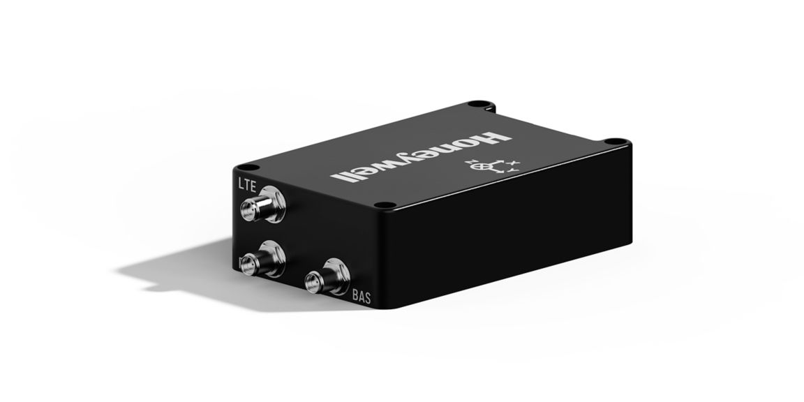
The Honeywell Radar Velocity System (HRVS) is a compact, lightweight, and low-power radar-based navigation-aiding solution designed for resilient UAV operations. Leveraging advanced millimeter wave sensing technology (60–64 GHz or 76–81 GHz), HRVS delivers precise range, velocity, and angle measurements with centimeter-level accuracy—regardless of environmental conditions such as rain, fog, dust, or snow.
Unlike vision-aided navigation systems, HRVS requires no maps or prior environmental data. It operates effectively from ground level up to 1 km altitude across all terrains (excluding still water) and in all weather conditions, making it a versatile and robust velocity-aiding source for inertial navigation systems.
HRVS is part of Honeywell’s Resilient UAV Navigation Suite, which also includes the Honeywell Compact Inertial Navigation System (HCINS) and the GPSdome Anti-Jamming System. When combined with HCINS, HRVS enables UAVs to navigate in fully GPS-denied environments with a position error of less than 3% of distance traveled.
Specifications
LED
- Yes
Typical Heading Error with HCINS
- 5 minutes < 1° (for outages > 15 minutes mag. heading aiding is recommended)
Velocity errors X/Y/Z axes 9m/s
- 0.09/0.04/0.03 Mean
- 0.45/0.45/0.10 RMS
Velocity errors X/Y/Z axes 6m/s
- 0.06/0.02/0.02 Mean
- 0.35/0.35/0.07 RMS
Velocity errors X/Y/Z axes 3m/s
- 0.02/0.02/0.003 Mean
- 0.20/0.20/0.04 RMS
Maximum Measurement Range
- 170m
Key Performance Variables
- Heading error, trajectory shape (open vs closed)
Typical Performance
- *1% of Distance Travelled
2-sigma Performance
- *3% of Distance Travelled
Types of Products
- Honeywell Radar Velocity System for Commercial Vehicles (HRVS-CV)
- Honeywell Radar Velocity System for Military Vehicles (HRVS-M)
- Honeywell Radar Velocity System for UAVs (HRVS-U)
- Radar (mmWave)
Key Benefits
- Altitude <300m
- Based on mmW sensor (60-64 GHz)
- Cm level-range accuracy
- Day/night operations
- Enables features: Velocity aid, altitude measurement, depth mapping , ground avoidance
- Error approx 1-2% distance travelled
- Guaranteed functionality with chosen Honeywell product lines such as Honeywell Compact Inertial Navigation System (HCINS)
- Helps in drones to navigate in GNSS outage scenarios with minimum deviation.
- Impervious to environmental conditions such as rain, fog, dust, and snow
- Impervious to environmental conditions such as rain, fog, dust, and snow
- Indefinite precise hover as error doesn’t grow with time (unlike INS)
- Indefinite precise hover as error doesn’t grow with time (unlike INS)
- Provides precise vertical velocity (e.g., for autoland)
- Provides range and velocity aiding to INS devices.
- Range measurement resolution down to 4cm
- Range up to 170m above the ground
- Supports high velocity ranges (theoretical limit ~250m/s)
Features
- Helps in drones to navigate in GNSS outage scenarios with minimum deviation.
- Provides range and velocity aiding to INS devices.
- Velocity aid (UAS)
- Velocity aid for no GNSS operations (Commercial vehicles)
- Velocity aid for no GNSS operations (Military vehicles)
Shock
- Yes
Surfaces with Limitations
- Lake (i.e. still water)
Operating Temperature
- -40°C to +85°C
Serial Communication
- yes
Operating Frequency
- 62.0±0.5GHz
Communication Ports
- Serial, CAN
Software
- Internal software (Honeywell proprietary)
Output
- Range and veocity information
Usually Bought With
- GPSDome
- HCINS
Tested Surfaces
- Asphalt
- Concrete
- Forest/trees
- Grass
- Greenfield
- Snow
Tested Range
- Up to 170m (UAS)
Used INS
- HCINS (MEMS based low-cost navigator – tactical grade - gyro bias instability 1 deg/h
Setup
- 1 x HRVS board (1.5m/0.6m above the ground) + INS (HCINS etc.) (Commercial vehicles)
- 1 x HRVS board (1.5m/0.6m above the ground) + INS (HCINS etc.) (Military vehicles)
- 4 x HRVS board + INS (HCINS, etc.) (UAS)
Power Consumption
- 1.7W nominal Watt
Supply Voltage
- +5VDC
Power
- 1.7W nominal Watt
Chassis Included
- Yes
Field of View
- 5.5° H x 5.5° V (-3dB)
Dimensions
- 113mm x 66mm x 13mm (Enclosed version)
Weight
- 24g (OEM version)
- 68g (Enclosed version)
Length
- 113 mm
Depth
- 13 mm
Size
- 108mm x 60mm x 10mm (OEM version) millimetre
- 113mm x 66mm x 13mm (Enclosed version) millimetre
Product Number