-
Location
-
North America
-
Latin America
-
Asia Pacific
- |
- Sales & Service Partners
- |
- Contact Us
- |
-
Select Shopping Cart Account
Choose the account number for your parts ordering shopping cart. Your current cart will be saved when switching accounts.
Account# Account Name City Zip/Post Code My Account
-
Support & Resources
Support & Resources
-
Location
-
North America
-
Latin America
-
Asia Pacific
- |
- Sales & Service Partners
- |
- Contact Us
- |
You are browsing the product catalog for
- Hardware and Systems
- Navigation & Sensors
- Honeywell Compact Inertial Navigation System
Your browser is not supported.
For the best experience, please access this site using the latest version of the following browsers:
By closing this window you acknowledge that your experience on this website may be degraded.
Honeywell Compact Inertial Navigation System
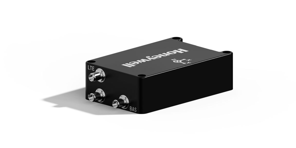
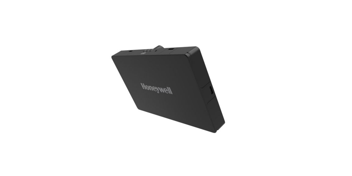
The size of a deck of cards, the Honeywell Compact Inertial Navigation System uses tactical-grade inertial sensors to provide centimeter-level accuracy to commercial and military customers.
The Compact Inertial Navigation System outputs position, orientation and velocity data.
What is a Compact Inertial Navigation System?
Honeywell’s Compact Inertial Navigation System is designed to cater to customers who need a highly-accurate navigation system in a small package with low weight and power requirements.
Our Compact Inertial Navigation System contains a 4G modem to receive RTK corrections which greatly improves the accuracy of the system while protecting the navigation accuracy of those who rely on it to navigate safely in GNSS-denied environments.
The Compact Inertial Navigation System has been engineered to work with other Honeywell navigation aids and third-party alternative navigation systems without significant upgrades and can be used as a standalone system or as a combined system with solutions such as our radar velocity system and/or anti-jamming systems such as GPSdome.
Compact Inertial Navigation System applications
Our Compact Inertial Navigation Systems are designed for customers who operate in the air, on the ground and at sea. It can be used in a variety of applications such as UAS, commercial and military surface vehicles and personal navigation system for dismounted applications. The compact inertial navigation system is ideal for customers ranging from UAVs to niche commercial vehicles that operate in GNSS-denied environments and experience intermittent or continuous GNSS outages.
Some applications where Compact Inertial Navigation System can be used:
- Military surface vehicles
- Niche commercial Land vehicles including autonomous vehicles
- Personal Navigation
- UAV – Military and Civil
Honeywell Compact Inertial Navigation System for UAVs (HCINS-U)
Our Compact Inertial Navigation System for UAVs (HCINS-U) offers tight integration with Pixhawk autopilot and is a plug-and-play solution to rotary and fixed-wing UAVs. It can receive RTK corrections through the in-built LTE modem and features a navigation health monitor to switch between various navigation sources (GNSS, INS, other alternative navigation sensors).
Honeywell Compact Inertial Navigation System for Personal Navigation (HCINS-P)
This version features additional ruggedization to operate in challenging environments. This is especially useful in military applications. For higher accuracy requirements, we also provide a high-performance variant of personal navigation. Additionally, this can also be integrated with a GPSdome, the anti-jamming system from our partner, InfiniDome.
Honeywell Compact Inertial Navigation System for Land (HCINS-CV & HCINS-M)
This version of our Compact Inertial Navigation System for land can be used in military vehicles and niche commercial vehicles for operations in GNSS-degraded environments. It is recommended to use our compact inertial navigation along with HRVS and GPSdome to be able to take full advantage of the superior performance of Honeywell’s inertial navigation system.
Resilient Navigation Packages to Avoid GNSS Outages
Honeywell’s philosophy of resilient navigation revolves around three layers of resiliency achieved by a combination of GNSS anti-jamming, inertial navigation and alternative navigation systems.
Option #1: GNSS Anti-jamming and Anti-spoofing Systems
If you operate in an environment where intentional low power GNSS jamming is likely to occur for short duration, we recommend a GPSdome.
Option #2: Intermittent GNSS Outages
Honeywell’s Compact Inertial Navigation System (HCINS) provides consistent navigation during intermittent GNSS outages like urban canyons or scenarios where anti-jamming systems don’t work.
If you operate in an environment where intentional high power GNSS jamming is likely to occur for short duration, we recommend a GPSdome and HCINS.
Option #3: Continuous GNSS Outages
Alternative navigation systems navigate during continuous GNSS outages for a longer duration. We have various alternative navigation systems in development and our first offering is a Radar Velocity System (HRVS) that utilizes millimeter wave radar technology to provide velocity measurements to aid inertial navigation systems.
Option #4: Long Duration GNSS Disruptions
If you operate in an environment where there is less likelihood of intentional GNSS disruptions, but you expect long duration GNSS disruptions (such as BVLOS missions), we recommend using our HCINS and HRVS.
Option #5: Powerful GNSS Jamming
If you operate in an environment where intentional high power GNSS jamming is likely to occur for a long duration, we recommend using GPSdome, HCINS and HRVS.
Related Products
Related Content
Press Release
Honeywell Launches New Navigation Systems
New resilient navigation systems designed for commercial and military applications allow continued operations even in Global Navigation Satellite Systems challenged or denied environments.
Press Release
Honeywell, InfiniDome To Develop New Technology That Protects GPS Signals
Joint solution will combine advanced sensors and ultra-strong GPS resilience technology to protect signals used by a wide array of vehicles.
Press Release
No GPS, No Problem: Honeywell Invents, Demonstrates Military-Grade Alternative...
All-new technologies use a variety of inputs to help ensure seamless navigation, even when GPS signals fail.
Press Release
Honeywell Successfully Completes In-Flight Demonstration of M-Code and...
Honeywell has successfully flight-tested new technologies designed to enable alternative navigation offerings, including its Embedded GPS Inertial Navigation System (EGI) supporting M-code, the new standard GPS signal used by militaries around the world.
Sign up to receive exclusive marketing e-communications including updates about our product offerings, special offers, news, and events.
Copyright © 2024 Honeywell International Inc.
Maximum File Size
Maximum Files Exceeded
Due to inactivity you will be logged out in 000 seconds.
Maximum File Size
Maximum Files Exceeded
Your documents are ready for you. Please click here to open.
Maximum File Size
Maximum Files Exceeded
There is an issue with invoices zip file download. Please go back and try again later. Thanks!
Maximum File Size
Maximum Files Exceeded
Your orders excel is ready for download. Please click here to download.
Maximum File Size
Maximum Files Exceeded
There is an issue with orders excel file download. Please go back and try again later. Thanks!