Scheduled Maintenance We will be conducting scheduled maintenance on 1/17 from 9:00 PM EST to 1/18​​ 8:00 PM EST. During this time MyAerospace applications will be temporarily unavailable. We apologize for any inconvenience this may cause.
×

Your browser is not supported.

For the best experience, please access this site using the latest version of the following browsers:

Close This Window

By closing this window you acknowledge that your experience on this website may be degraded.

TALIN Inertial Land Navigator Family
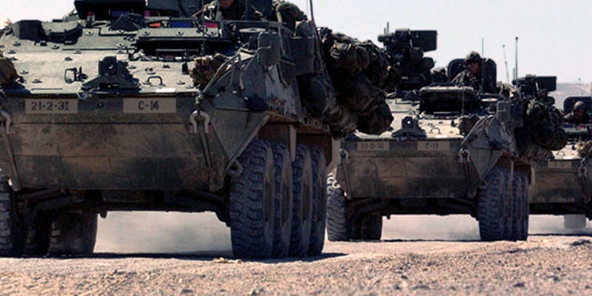
TALIN Inertial Land Navigator Family

Highly accurate, shock-stabilized position and pointing inertial navigation system for use on military and commercial surface platforms.

Honeywell’s tactical advanced land inertial navigator (TALIN) utilizes our industry-leading GG1320 digital ring laser gyro and Q-Flex accelerometers to provide customers with highly durable, precise and reliable inertial navigation systems.

TALIN inertial navigation systems are proven, battle-tested and are used in a variety of different applications with more than 16,000 TALIN systems in the air, on land and at sea across 60 commercial and military platforms worldwide.  

TALINs are easily installed and can be mounted in any orientation, which provides customers with an inertial navigation system that is smaller, lighter and more reliable than other competing products.

Whether you’re looking for our best-in-class, TALIN 2000, a commercial option like our TALIN 1000, or a cost-effective TALIN 6000, our performance levels are configurable to meet a variety of different compatibility and price requirements.

The TALIN portfolio offers a range of inertial navigation systems to meet your needs: 

Application

Use case / Environment

Recommended Products

Artillery Ethernet interface and can withstand high shock environments
  • aTALIN
Construction, Geological Survey, Maritime, Mining, Oil & Gas Pointing accuracy and precision navigation in GPS denied conditions
  • TALIN 1000
Light military vehicles Basic GPS denied navigation 
  • TALIN 500
Military Survey Small, cost-effective, lightweight north finder (LWNF) and high precision simplified survey system
  • Simplified Survey System
Military vehicles and tanks Pointing accuracy and precision navigation in GPS denied conditions 
  • TALIN
  • TALIN 1000
  • gTALIN with an embedded GPS
  • eTALIN II
  • eTALIN Mini
Mobile Radars – towed and man-portable radars Pointing accuracy and precision navigation in GPS denied conditions
  • TALIN 1000
Radar/satcom stabilization, missile launcher pointing/stabilization Balance price and performance
  • TALIN
  • gTALIN
  • eTALIN II
Secondary Safety Navigation System for Indirect Fire Pointing accuracy and precision navigation in GPS denied conditions
  • TALIN 1000

Brochures  (10)
Brochures  (10)
TALIN Land Products
Download File Multiple Download been Selected
TALIN 500
Download File Multiple Download been Selected
TALIN 1000
Download File Multiple Download been Selected
Simplified Survey System (U.S. Army)
Download File Multiple Download been Selected
TALIN ACCESS
Download File Multiple Download been Selected
aTALIN
Download File Multiple Download been Selected
eTALIN
Download File Multiple Download been Selected
eTALIN II
Download File Multiple Download been Selected
gTALIN
Download File Multiple Download been Selected
TALIN
Download File Multiple Download been Selected
Customer Success Story  (1)
Poland's armed forces find their way with Honeywell
Download File Multiple Download been Selected
Infographic  (1)
Infographic  (1)
TALIN
Download File Multiple Download been Selected

Please fill out the form to speak with one of our technical managers

Related Products